12 SHARRON DRIVE
Owner Information
SPENCER CANDACE A
12 SHARRON DRIVE UNIT 12
SOUTH EASTON, MA 02375


Property Details
12 SHARRON DRIVE is classified as a CONDO NL MDL-00 (Condominium).
The primary structure on this property was built in 1983. There are 1,764ft2 of built area within this property. There is 1,080ft2 of residential/living space within this property. This property is listed as having 6 rooms.
12 SHARRON DRIVE is valued at $262,900. The land is valued at $0 and the structures are valued at $262,900.
This property is in Zone BUS. Confirm with local Zoning Board authorities to ensure there are no overlays or other easements on this property.
The most recent deed for 12 SHARRON DRIVE is recorded at the local registrar in Book 22873, Page 0299. 12 SHARRON DRIVE was last sold on Friday, March 25, 2016 for $195,000.
Assessment data from fiscal year 2022.
Flood Data
According to the FEMA National Flood Hazard Layer, this property does not appear to be in a flood zone. It may also be in an area not yet reviewed. Nonetheless, confirm this information prior to taking any action.
To view the flood hazards around this property, create a FEMA "Firmette" Map of the area around 12 SHARRON DRIVE.
Broadband Internet Providers
| Provider | Type | Bandwidth (mbps) | |
|---|---|---|---|
| Viasat Inc | Satellite | 100 | 3 |
| VSAT Systems, LLC. | Satellite | 2 | 1 |
| HughesNet | Satellite | 25 | 3 |
| GCI Communication Corp. | Satellite | 0 | 0 |
Broadband service provider data from December 2020.
Adjacent Properties
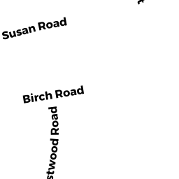
- 8 BIRCH ROAD
Single Family Residential owned by GATTAS CARLOS & KIRKCALDY AMY G TRS - 8 WESTWOOD ROAD
Single Family Residential owned by STITT JENNIFER E - 2 HERMOSA DRIVE
Single Family Residential owned by KEHLING, MICHELE - 12 WESTWOOD ROAD
Single Family Residential owned by HACKER RICHARD A & CAROL F - 909 WASHINGTON STREET
Single Family Residential owned by FIGUEROA JONATHAN - 6 BIRCH ROAD
Single Family Residential owned by RYAN ANN M - 863 WASHINGTON STREET
Single Family Residential owned by TREMBLAY SANDRA B. - 360 PURCHASE STREET
Vacant, Conservation (Municipal or County) owned by EASTON TOWN OF